|
This information regarding soils might be useful to anyone moving into the area, who wants to farm, ranch, grow a garden, orchard, or plans to do landscaping.
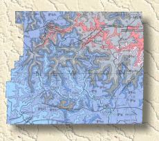
Parent Material The soils of Newton County formed in material that weathered from consolidated bedrock of the Ordovician through Pennsylvanian Periods of the Paleozoic Era. Newton County is in the Salem, Springfield, and Boston Mountain Plateaus of the Ozark Plateau Province. The Salem Plateau is the oldest, lowest in elevation, and northernmost of the three surfaces. It roughly parallels the Buffalo River from the west part of the county to the east part. The Springfield Plateau is intermediate in age and elevation. It is south of the Salem Plateau. The Boston Mountain Plateau is the youngest and the highest in elevation of the surfaces. It covers the northwest and southern parts of the county. The St. Peter Sandstone and Everton Formation of Middle Ordovician age are exposed over most of the Salem Plateau. Areas of the Powell dolomite are exposed along the larger streams in Newton County.
The Everton Formations consists of brownish gray, sandy crystalline dolomite in the lower part. This grades into fine-to medium-grained sandstone. The upper Everton Formation consists of sandy oolitic limestone that grades laterally into sandy dolomite. St. Peter Sandstone overlies the Everton Formation. It consists of massive upper and lower fine- to medium-grained sandstone units that have fine-grained sandstone interbedded with dolomite between them. Plattin Limestone, Fernvale Limestone, Cason Shale, and St. Clair Limestone of the Upper Ordovician and Silurian periods form discontinuous wedges between outcrops of the St. Peter Sandstone and the Boone Formation. In outcrops above the St. Peter Sandstone and below the Boone Formation, one or more of these formations are exposed. Estate and Lily soils formed in residuum from these formations. The Boone Formation of the Mississippian Periods caps the upland and the ridges throughout the north central part of Newton County. This formation forms the Springfield Plateau, which is highly eroded and dissected. The Boone Formation consists of three distinct lithologic units. The basal unit is a fine- to coarse-grained sandstone that ranges in thickness from a few inches to a few feet. The middle unit, the St. Joe Limestone Member, consists of very finely crystalline limestone. The upper unit, which is the thickest unit, is interbedded light gray, medium-crystalline, fossiliferous limestone and medium gray to brownish gray chert. The chert content varies vertically and laterally in the formation. The limestone weathers more rapidly than the chert. Clarksville, Nixa, and Noark soils, which contain large quantities of chert, formed in these areas. Fayetteville Shale and Pitkin Limestone are exposed on the north escarpment of the Boston Mountains. Fayetteville Shale consists of dark gray shale and dark gray, microcrystalline, petroliferous limestone. Pitkin Limestone consists of medium gray limestone that has thin beds of dark gray limy shale. This unit contains small quantities of dark gray chert. Eden and Newnata soils formed in these areas. The Hale Formation is exposed in most of the Boston Mountain Plateau in Newton County. This formation is made up of the Cane Hill Member, Bloyd Shale, and the Prairie Grove Member. These members consist mainly of fine- to coarse-grained sandstones and shales. Enders, Nella, and Steprock soils formed in these areas. Sediment deposited by the Buffalo River, Little Buffalo River, and numerous smaller streams is the parent material of soils on terraces and flood plains. This alluvium is a mixture of material derived from many different kinds of soil, rock, and unconsolidated material. It was transported by water from uplands in Newton County and from counties to the west. Razort, Ceda, Wideman, and Spadra soils formed in this material.
Climate The climate of today in Newton County is similar to the climate under which the soils formed. It is characterized by relatively cool winters and warm to hot summers with fairly abundant rainfall. The average daily maximum temperature is 91 degrees Fahrenheit in July and 46 degrees Fahrenheit in January. Annual rainfall is about 48 inches and is generally well distributed throughout the year. The warm, moist climate promotes rapid soil formation and encourages rapid chemical reactions.
Relief The relief in Newton County is the result of geologic erosion and entrenchment of streams and drainage channels into the land surface; in a few places, it is the result of faulting. The highest point in Newton County, which is about 2,561 feet above sea level, is about I mile west of Arkansas State Highway 43 at the Buffalo Lookout tower. The lowest point, which is about 680 feet above sea level, is in the eastern part of the county where the Buffalo River leaves the county. Some of the greatest differences in the soils of Newton County are caused by differences in relief through its effect on drainage, runoff, erosion, and percolation of water through the soil. Relief ranges from nearly vertical bluffs to broad, nearly level and gently sloping areas.
Some soils on the steeper slopes, narrow ridges, and mountaintops are shallow because they have lost so much materiel through geologic erosion. Moko and Mountainburg soils are examples. In other areas of strong relief, soils formed in cherty limestone. These soils contain large quantities of chert residue from weathered limestone. Clarksville and Noark soils are examples. The chert mantle retards geologic erosion. In contrast, soils that are on nearly level to gently sloping uplands, such as Leadvale, Peride, and Linker soils, have lost little soil material through geologic erosion. These are some of the better soils for growing row crops. Nella and Leesburg soils formed on colluvial slopes in deep accumulations of material that washed or sloughed down from adjacent higher slopes. Spadra and Britwater soils, which are on gently sloping stream terraces, formed in deep loamy material that washed from uplands and was deposited on stream flood plains before the streams were further entrenched. The soils on the flood plains and low terraces along streams in Newton County are level or nearly level. These soils are subject to flooding. The Spadra, Ceda, Kenn, and Razort soils formed in these areas in deep, silty or loamy alluvium that contains chert or gravel in places.
Additional Information
Newton County
Cooperative Extension Service
(870)446-2240
Newton County
Conservation District
(870)446-2236
Boone/Newton Office of
the Natural Resource Conservation Service
(870)741-2307
Soil Physics
Laboratory University of Arkansas
http://www.uark.edu/depts/agronomy/scott/gis/
|